Bathymetric surveying involves the precise measurement and charting of underwater topography and depths.
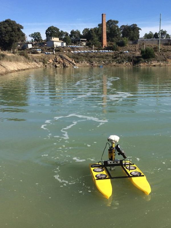
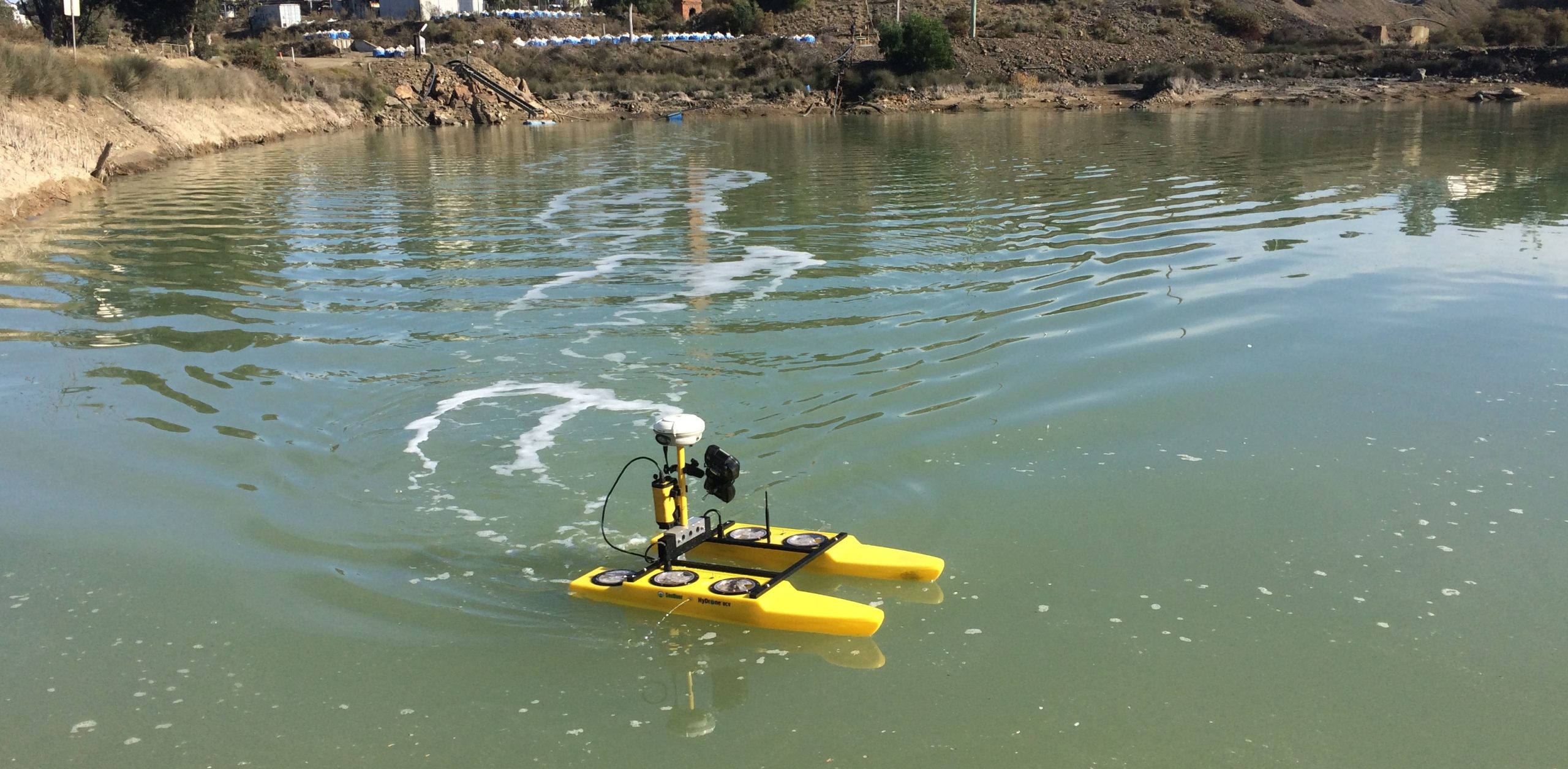
Bathymetric surveys are typically conducted using specialised equipment, including echo sounders, sonar systems, and remotely operated vehicles (ROVs). These tools send acoustic signals or sound waves to the seabed or lake bottom and measure the time it takes for the signals to bounce back. By analysing the return signals, surveyors can calculate the depth and shape of the underwater terrain.
The resulting bathymetric data is often presented as contour maps or 3D models, which provide valuable information for a wide range of applications.
Applications of bathymetric surveying
MinStaff Survey provides bathymetric and hydrographic surveying services to a range of clients to produce quality survey plans and charts of catchment areas to determine:
Water Depth
Configuration and nature of bottom
Locations of topographic features and fixed underwater objects.
These services are predominately used to cater for the unique requirements of local councils and environmental agencies for flood studies and planning as well as mining, oil and gas companies to map holdings ponds, tailings dams and water storage facilities.
MinStaff Survey completes these works with the utilisation of modern, state-of-the-art sonar technology and equipment which is used in all facets of bathymetric surveying and data management.